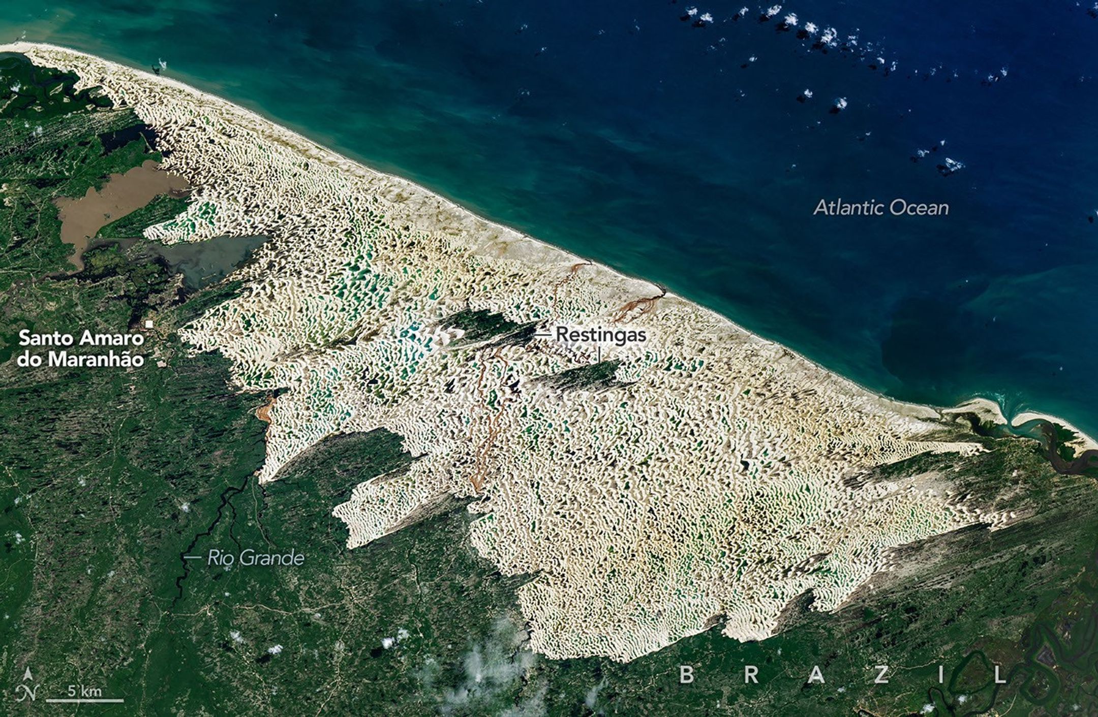
Vast fields of white sand dunes stretch across Lençóis Maranhenses National Park along Brazil’s northeastern coast, but despite its desert-like appearance, the landscape receives enough seasonal rainfall to fill thousands of temporary freshwater lagoons between the dunes.
The OLI (Operational Land Imager) on Landsat 9 captured this image on June 8, 2026, when blue and green pools punctuate the sweeping dune field. Rain typically fills the lagoons from January through June, with water levels peaking between June and September before much of it evaporates during the dry season.
The unusual combination of shifting sand and seasonal freshwater supports fish and other aquatic life, some of which persist through the dry months in moist sediment before emerging when the lagoons return. UNESCO declared the park a World Heritage site in 2024, citing its remarkable geology and rich biodiversity.
Image Credit: NASA Earth Observatory images by Michala Garrison, using Landsat data from the U.S. Geological Survey
Featured
The Paradox of Lençóis Maranhenses National Park