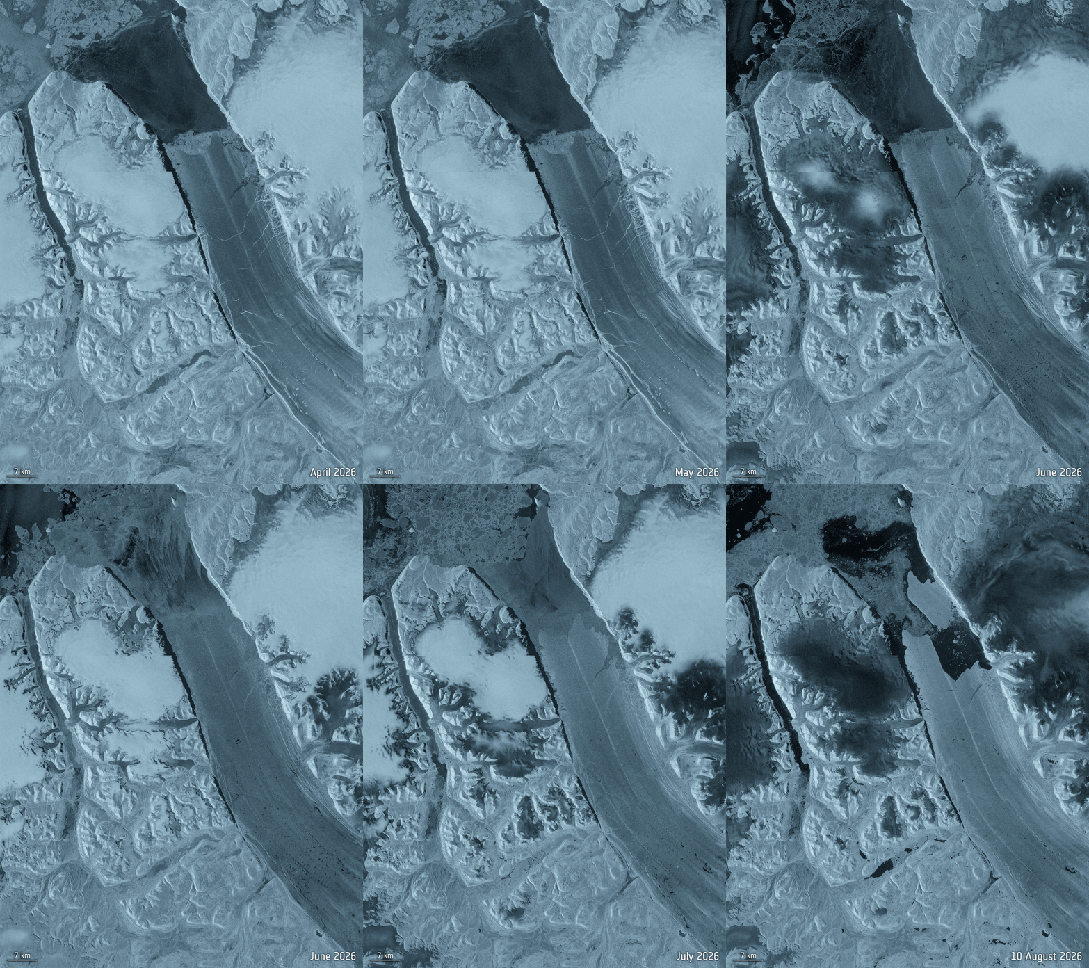
[caption id="attachment_468330" align="alignleft" width="345"] The full animated gif can be viewed at the www.eijournal.com homepage. (Credit: Contains modified Copernicus Sentinel data (2026), processed by ESA)[/caption]A massive section of Greenland’s Petermann Glacier broke away in early August 2026, removing about 76 square kilometers of floating ice from the glacier’s tongue. Copernicus Sentinel-1 radar imagery shows the glacier before and after the Aug. 4 breakaway. An interferogram combining Sentinel-1 radar observations with a Copernicus Sentinel-2 image reveals fractures and movement in the ice preceding the event. The loss was Petermann Glacier’s largest since 2012 and further shortened a floating ice tongue that has retreated substantially during the past two decades.
Sustainable Systems
Sentinel-1 Captures Major Ice Loss From Greenland Glacier