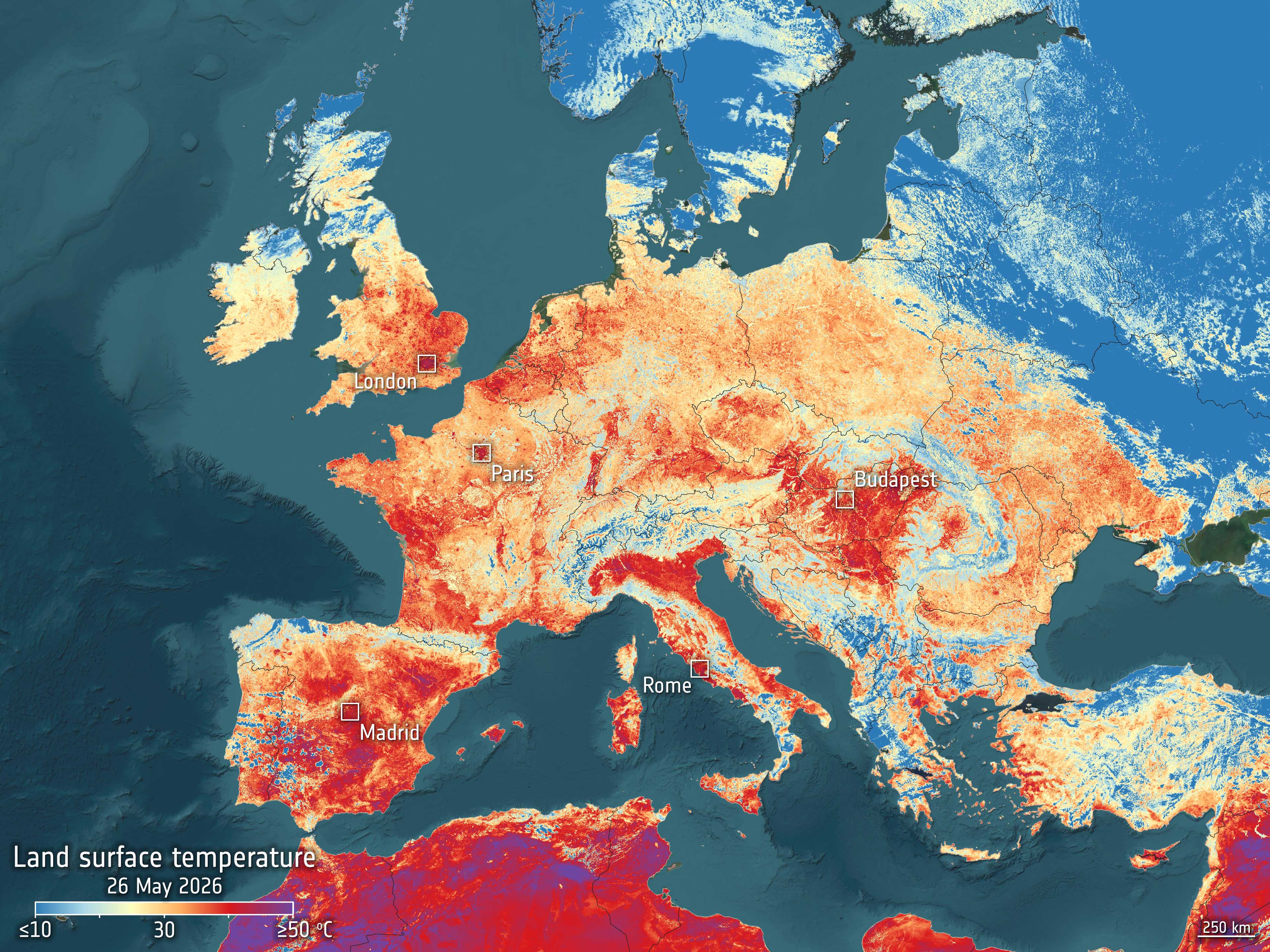
For more than a decade, Europe’s Copernicus Sentinel-3 satellites have gathered measurements of Earth’s oceans, land, ice and atmosphere, building a long-term record scientists use to track environmental and climate change. Sentinel-3 measures variables ranging from sea- and land-surface temperatures to ocean color, vegetation, wildfire activity and the height of rivers and lakes. Its observations also contribute to measurements of sea-ice thickness and changes in Earth’s water cycle. Land-surface temperature observations have provided particularly visible evidence of extreme heat. A Sentinel-3 image acquired May 26, 2026, shows elevated surface temperatures across Europe during an unusually early heatwave. Unlike standard weather reports, the image measures the temperature of Earth’s surface rather than the air above it; exposed soil and other surfaces can become considerably hotter than the surrounding air. The mission’s combination of radiometers, imaging spectrometers and radar altimeters allows scientists to observe interconnected changes across land and ocean rather than studying individual parts of the Earth system in isolation. Credit: Contains modified Copernicus Sentinel data (2026), processed by ESA
Top Stories
How Sentinel-3 Tracks Climate Change