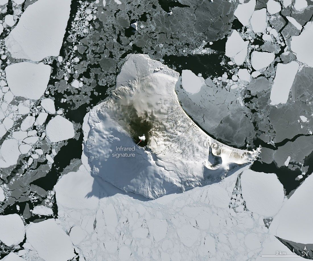
A rare cloud-free satellite view of remote Mount Michael in the South Atlantic reveals heat from one of the world’s few known persistent lava lakes.
The image, acquired by the Operational Land Imager (OLI) on Landsat 8 on Aug. 24, 2026, shows Mount Michael rising from ice-covered Saunders Island in the South Sandwich Islands. An infrared signal overlaid in red reveals heat from the lava lake in the volcano’s summit crater.
A small volcanic plume and darkened snow on the northern slopes provide additional signs of activity. Because of Mount Michael’s remote location, satellites are particularly important for monitoring the volcano. Researchers analyzing decades of Landsat, Sentinel and ASTER observations previously concluded that the crater contains a persistent lava lake.
Saunders Island is one of the South Sandwich Islands, a string of small volcanic peaks about 350 kilometers (220 miles) long that formed from the South American plate subducting beneath the tiny South Sandwich plate.
Credit: NASA Earth Observatory/Michala Garrison, using Landsat data from the U.S. Geological Survey
Featured
A Bright Spot at Mount Michael