
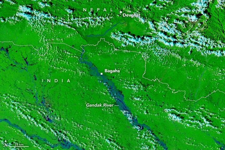
 Before[/caption]
[caption id="attachment_468532" align="aligncenter" width="610"]
 After[/caption]
Days of torrential rain in Nepal sent the Gandak River to record levels in late September 2026, flooding farmland and communities along hundreds of kilometers of the river in Nepal and India.
Storms drenched Nepal’s Lumbini and Gandaki provinces from Sept. 24-27, triggering landslides and sending runoff into the braided river system. Water overtopped or breached embankments in several locations, and reports indicated that thousands of people were displaced.
MODIS instruments aboard NASA’s Terra and Aqua satellites captured the extent of the flooding. False-color images from Sept. 20 and Sept. 29 show the Gandak before and after the heavy rainfall, with floodwater appearing blue and vegetation bright green. A gauge at Devghat, Nepal, reached 11.94 meters on Sept. 27—the highest level recorded there since measurements began in the 1960s. Several gauges downstream in India also reached new highs.
Image Credit: NASA Earth Observatory images by Lauren Dauphin, using MODIS data from NASA EOSDIS LANCE and GIBS/Worldview