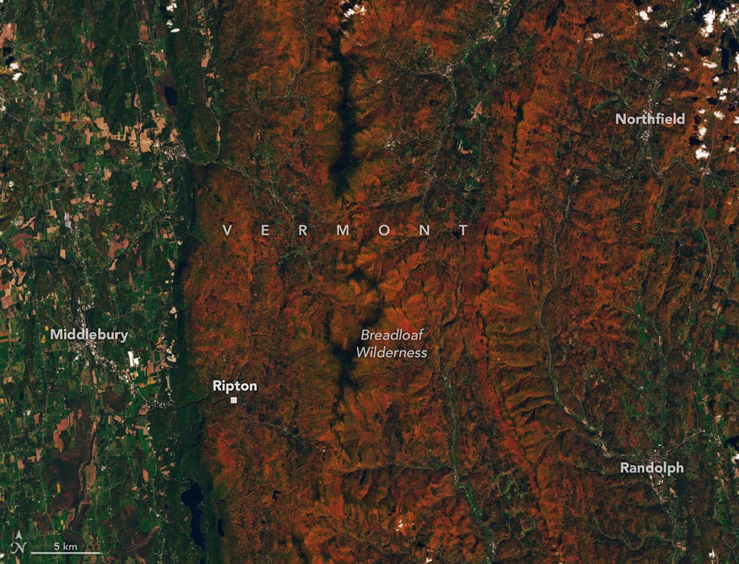
Autumn foliage is more than a seasonal spectacle for NASA scientists. Measurements from the agency’s PACE satellite are helping researchers follow changing leaf pigments across the planet, while Landsat 9 imagery offers a detailed view of forests as they turn red and orange. PACE’s Ocean Color Instrument observes Earth in 286 spectral bands, including wavelengths that help distinguish chlorophyll, which gives leaves their green color; carotenoids, associated with yellow and orange; and anthocyanins, associated with red. Comparing the pigment signals over time lets scientists map where seasonal color is emerging, peaking or fading. NASA’s maps from late September and early October 2026 show the progression of red foliage across northern regions and toward lower latitudes. A Landsat 9 image acquired Oct. 3, 2026, shows forested ridges around Ripton in central Vermont turning vivid red and orange while river valleys and lower elevations remain green. NASA notes that the combination of PACE’s frequent, broad-area hyperspectral observations and more detailed satellite imagery offers a new perspective on vegetation changes. Image Credit: NASA Earth Observatory/Lauren Dauphin
Industry Insights & Trends
Satellites Track Autumn’s Changing Colors From Space