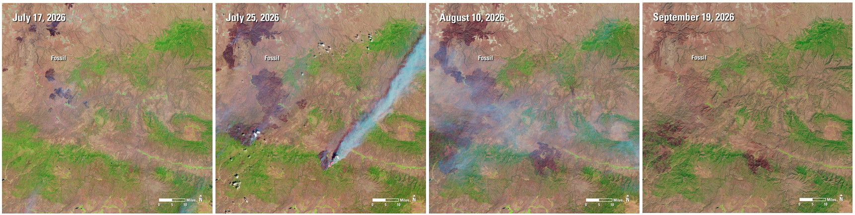
A series of Landsat satellite images documents the progression and aftermath of major wildfires across north-central Oregon during summer 2026. The Rowe Creek Complex fire, ignited by lightning near Fossil, Ore., in July, spread through grasslands, brush and forests, burning nearly 374,000 acres by late August, according to the U.S. Geological Survey.
Images collected by Landsat 8 and Landsat 9 show the landscape during and after the fires, including broad, dark burn scars that mark where vegetation was damaged or destroyed. Viewed together, the observations make the extent of the fires visible across a region too large to assess easily from the ground.
Image Credit: U.S. Geological Survey (USGS); public domain
Industry Insights & Trends
Landsat Reveals Scars Left by Oregon Wildfires