Signs of Thaw in Bering Sea
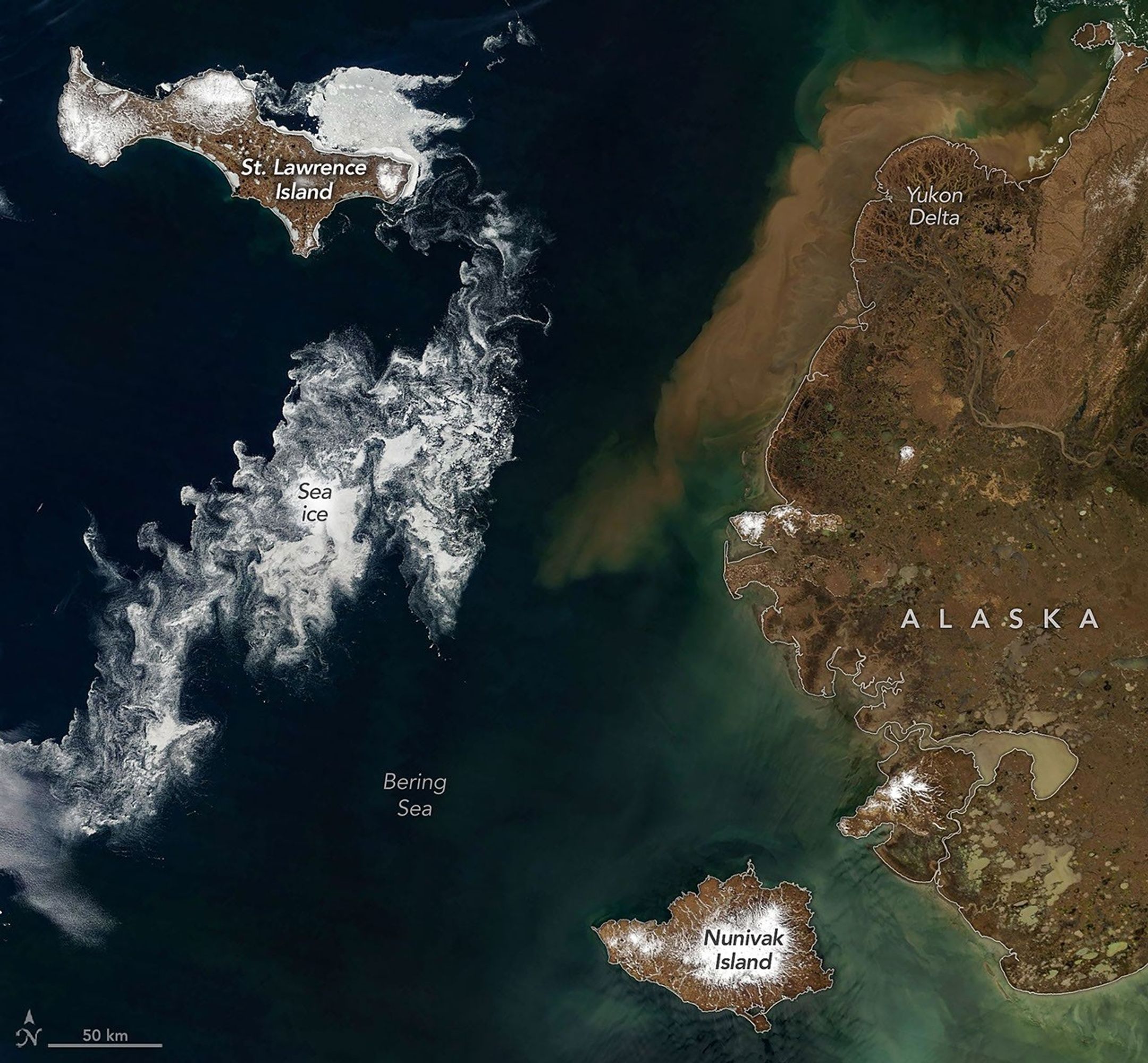
Satellite imagery collected during late June 2026 reveals widespread seasonal ice retreat across the Bering Sea, highlighting ongoing changes in one of the worl...
Geospatial1 brings Earth Imaging Journal, Sensors & Systems and Asian Surveying & Mapping together as one media resource. V1 Media is the parent of Geospatial1 and Informed Infrastructure.
Satellite imagery collected during late June 2026 reveals widespread seasonal ice retreat across the Bering Sea, highlighting ongoing changes in one of the worl...

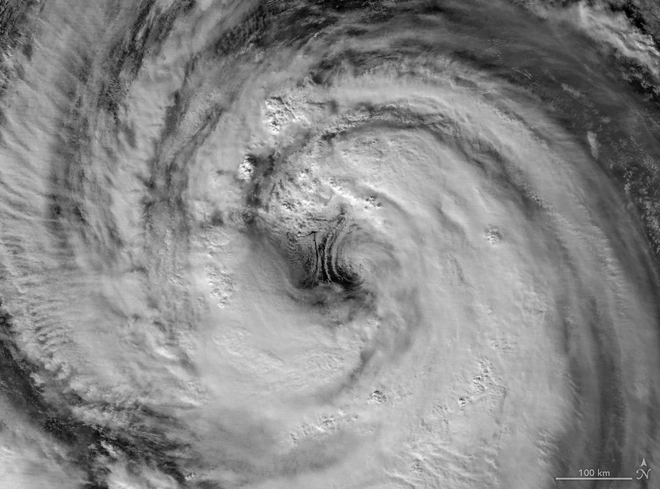
Typhoon Jangmi churned across the western Pacific Ocean in early June 2026, producing a nighttime view captured by the Visible Infrared Imaging Radiometer Suite...
During summer 2026, Ocean Exploration Trust (OET) and its partners will explore deep-sea habitats in the Central and Western Pacific using E/V Nautilus, its map...
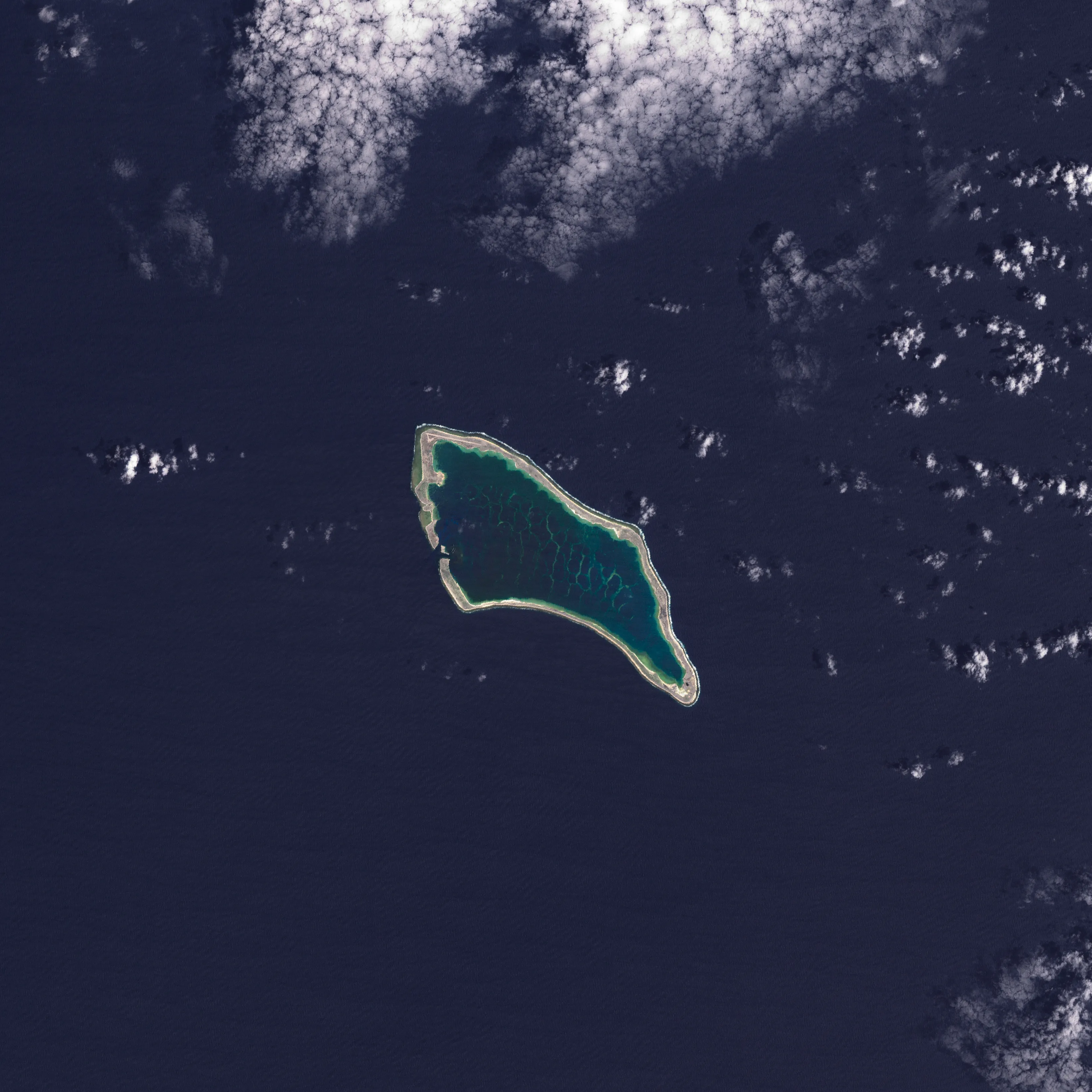
In the next 30 years, Pacific Island nations such as Tuvalu, Kiribati (pictured) and Fiji will experience at least 6 inches (15 centimeters) of sea-level rise,...
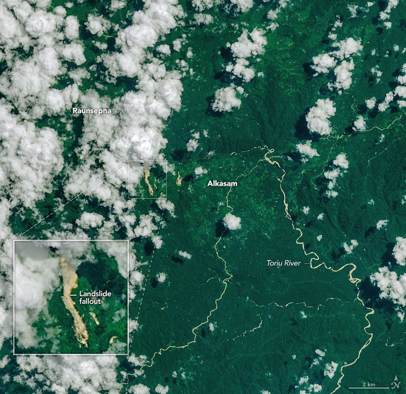
Heavy rains triggered by a tropical cyclone have caused widespread landslides across Papua New Guinea, with satellite imagery providing a detailed look at the d...
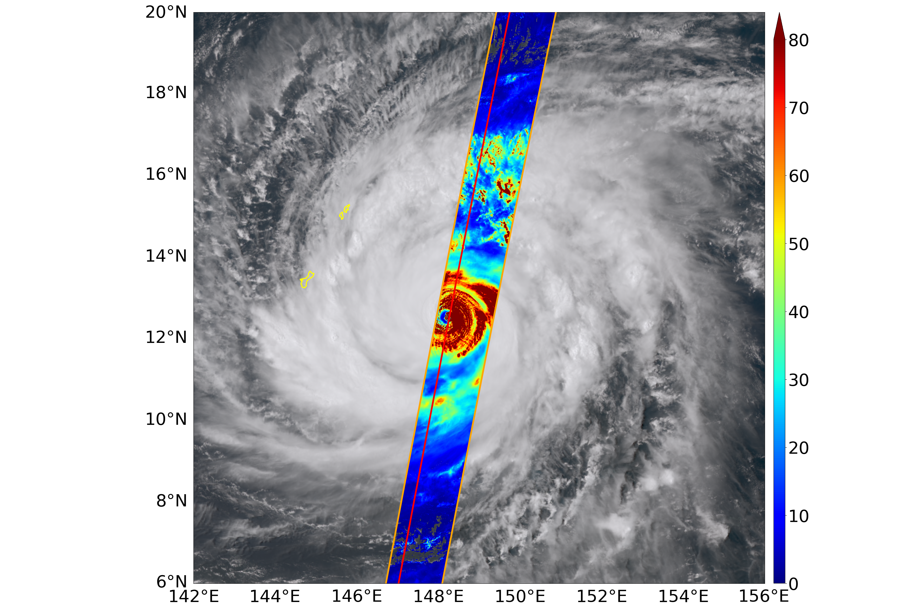
The EarthCARE satellite (Japanese name: Hakuryu) successfully passed directly over the eye of Typhoon Sinlaku on April 13, 2026, capturing unprecedented observa...
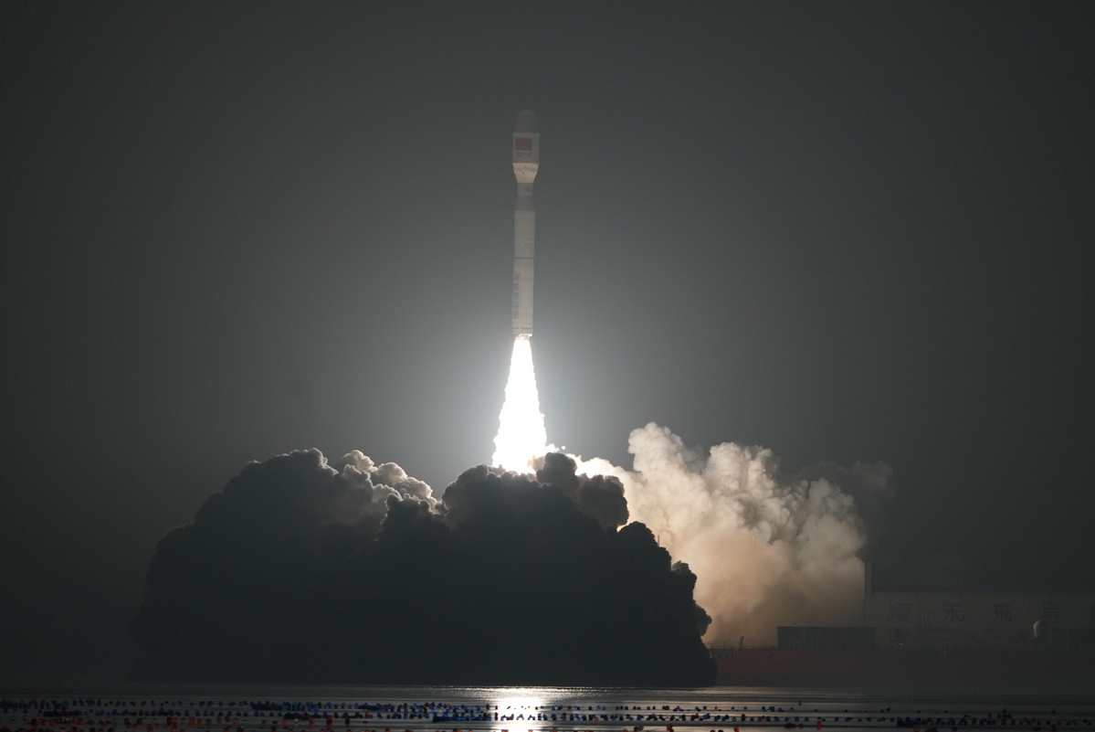
On March 22, 2026, China placed 10 satellites into orbit with the launch of a Smart Dragon 3 carrier rocket from off the coast of Haiyang in Shandong province. ...
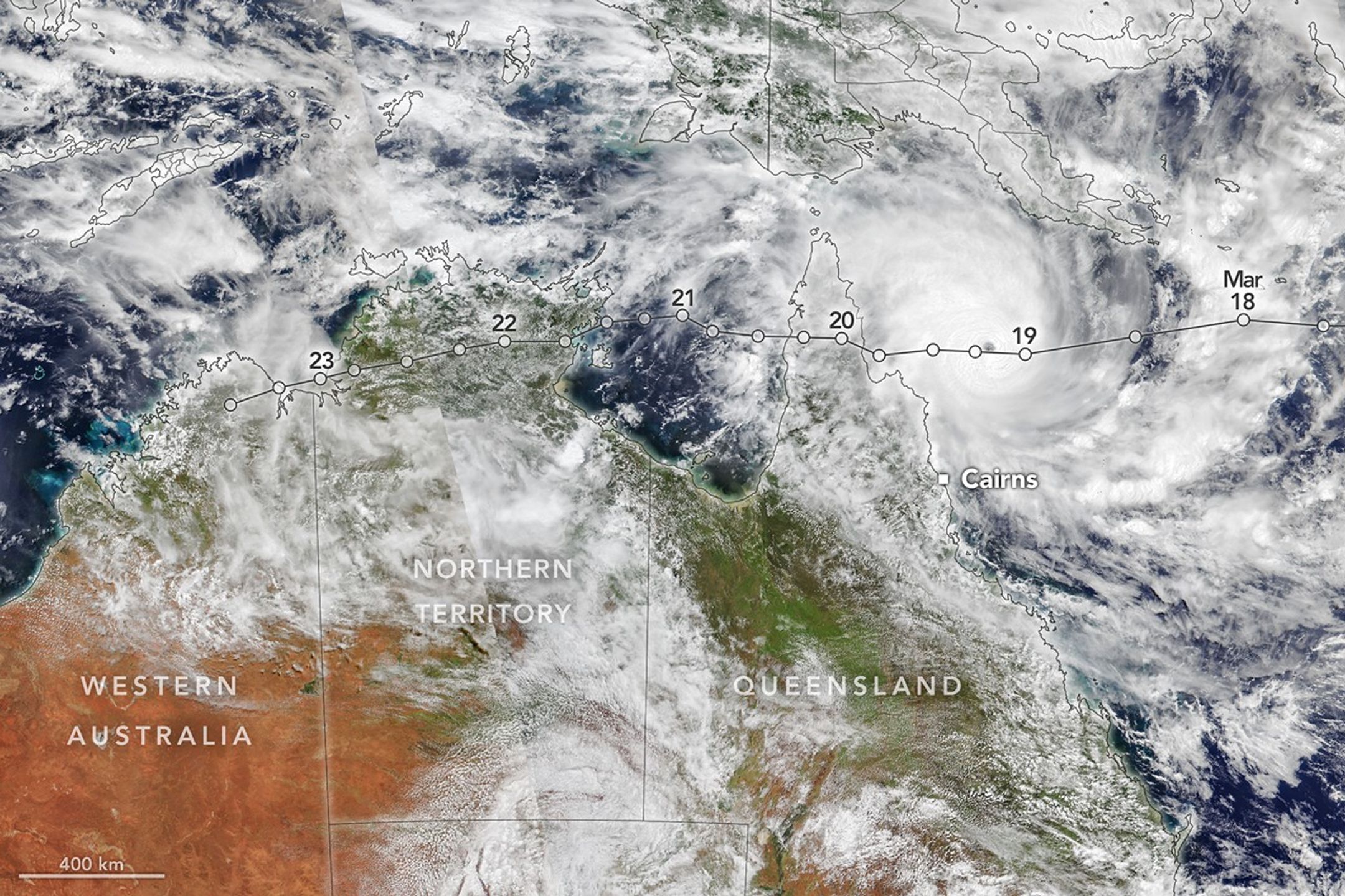
Tropical Cyclone Narelle traced a long path across the northern edge of Australia, bringing damaging winds and rain to areas already saturated with abundant pre...
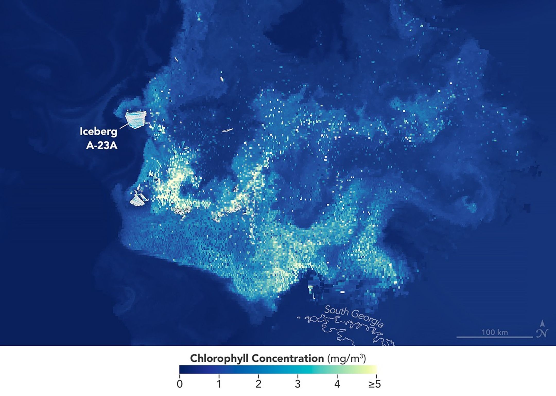
Iceberg A-23A has had a more eventful run than most of the large Antarctic icebergs that have calved from the continent’s ice shelves in recent decades. Over it...
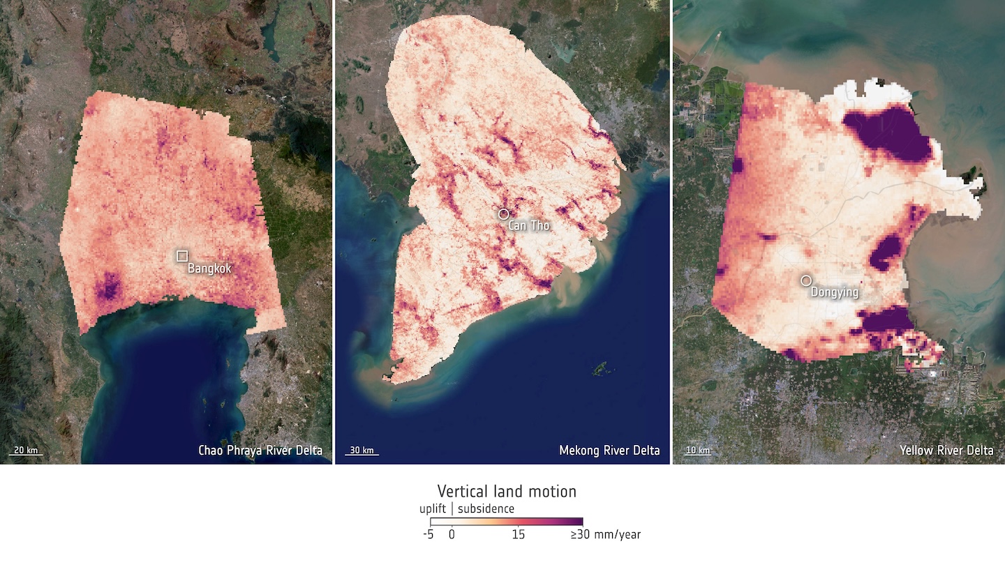
Using a decade of satellite radar observations from Copernicus Sentinel-1, researchers mapped surface elevation changes across 40 major river deltas worldwide....