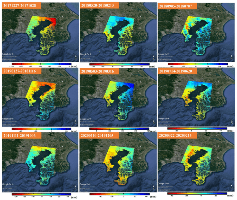
Investigating Land Subsidence in Japan
Land subsidence causes Earth’s surface to sink, flooding coastal areas and damaging infrastructure. It can be monitored using observation wells, global navigati...
Geospatial1 brings Earth Imaging Journal, Sensors & Systems and Asian Surveying & Mapping together as one media resource. V1 Media is the parent of Geospatial1 and Informed Infrastructure.
Land subsidence causes Earth’s surface to sink, flooding coastal areas and damaging infrastructure. It can be monitored using observation wells, global navigati...
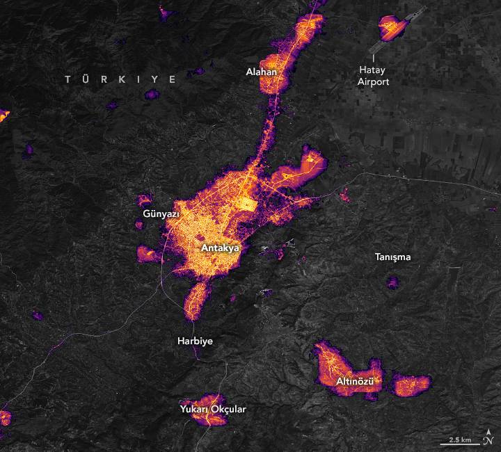
On Feb. 6, 2023, magnitude 7.8 and 7.5 earthquakes hit southern Türkiye and northwestern Syria, causing significant losses of life and destruction to infrastruc...
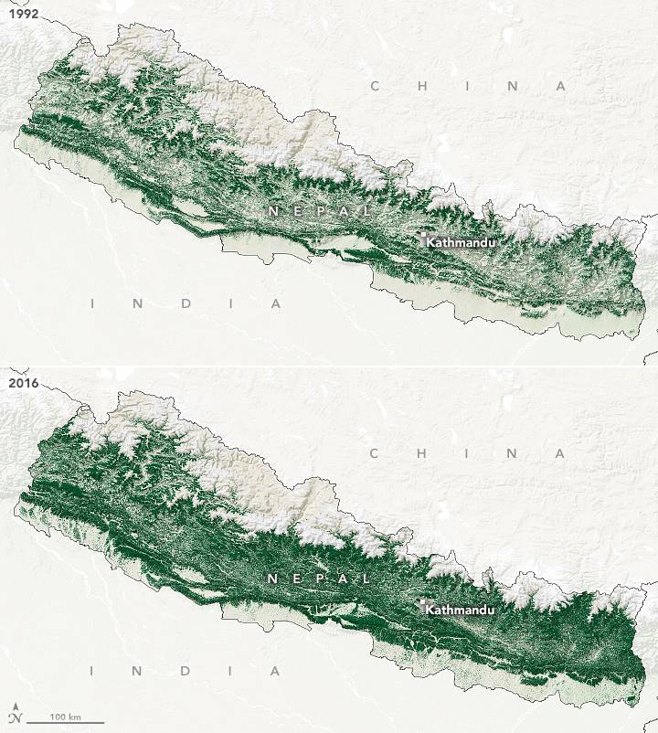
In the 1970s, Nepal was facing an environmental crisis. Forests in Nepal’s hillsides were being degraded due to livestock grazing and fuelwood harvesting, which...
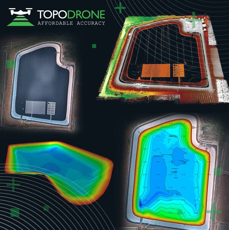
The synchronization was performed upon a request from the Israeli drone service provider ERELIS to conduct a pilot project of reservoir surveying with a UAV for...
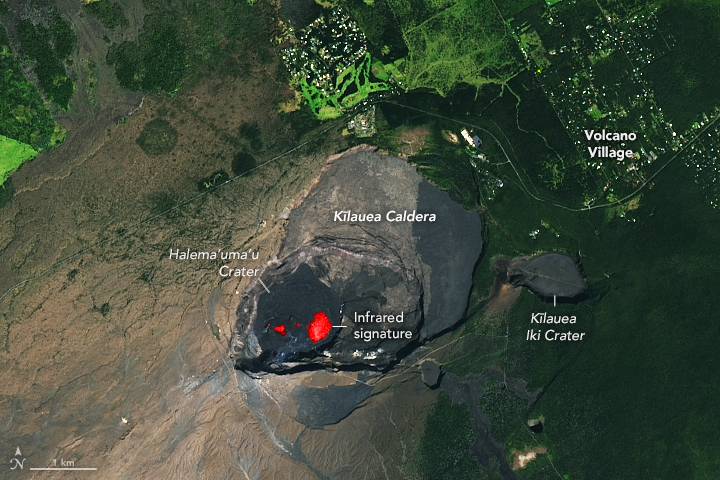
On Jan. 5, 2023, Kilauea—Hawaii’s youngest and most active volcano—began erupting once again. Scientists at the U.S. Geological Survey’s Hawaiian Volcano Observ...
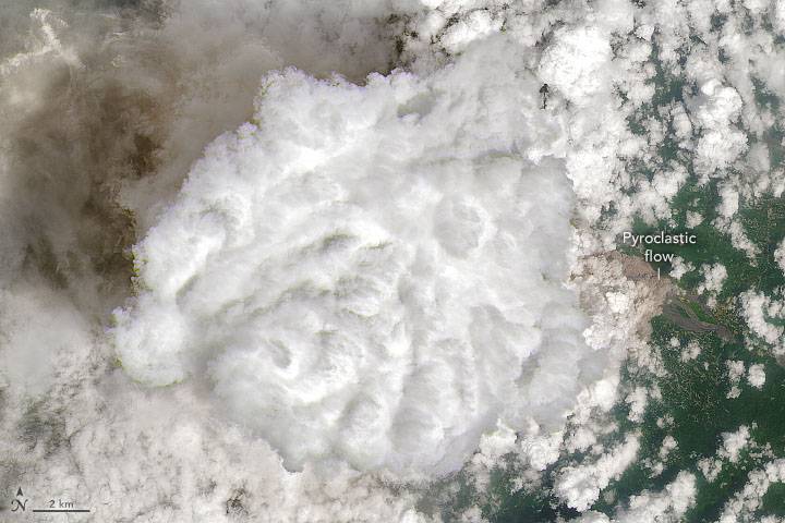
One year after Indonesia’s Mount Semeru unleashed a destructive eruption, the tallest and most active volcano on Java erupted again in early December 2022. Late...
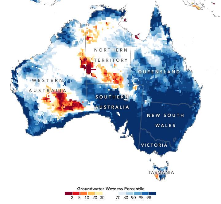
After an extremely wet October, southeast Australia continued to see heavy rainfall in November 2022. With soils already saturated and dams full, the latest sto...