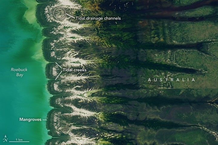
Large tides transform the appearance of Roebuck Bay along the coast of Western Australia, exposing broad expanses of intertidal mudflats that support one of the Southern Hemisphere’s most important concentrations of migratory shorebirds.
Located near Broome in the Kimberley region, the crescent-shaped bay experiences tidal ranges that can exceed 9 meters (30 feet). As water retreats, it exposes nutrient-rich mudflats containing mollusks, worms and other organisms that provide abundant food for birds.
This image shows the bay on March 18, 2026, when water levels were high. Green mangrove forests grow thickly along the shoreline and line the mouths of a network of evenly spaced, linear tidal creeks.
Image Credit: NASA Earth Observatory image by Lauren Dauphin
Featured Images
Tidal Movements in Australia’s Roebuck Bay